


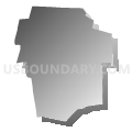
West Hartford, Farmington, Simsbury, Bloomfield, Avon & Canton Towns PUMA, Connecticut
About
Outline

Summary
| Unique Area Identifier | 192509 |
| Name | West Hartford, Farmington, Simsbury, Bloomfield, Avon & Canton Towns PUMA |
| State | Connecticut |
| Area (square miles) | 160.19 |
| Land Area (square miles) | 157.58 |
| Water Area (square miles) | 2.61 |
| % of Land Area | 98.37 |
| % of Water Area | 1.63 |
| Latitude of the Internal Point | 41.81337870 |
| Longtitude of the Internal Point | -72.82409390 |
Maps

Graphs
Select a template below for downloading or customizing gragh for West Hartford, Farmington, Simsbury, Bloomfield, Avon & Canton Towns PUMA, Connecticut


Neighbors
Neighoring Public Use Microdata Area (by Name) Neighboring Public Use Microdata Area on the Map
- Bristol, Southington & Burlington Towns PUMA, CT
- Glastonbury, Newington, Wethersfield, Rocky Hill & Marlborough Towns PUMA, CT
- Hartford County (North) PUMA, CT
- Hartford Town PUMA, CT
- Litchfield County PUMA, CT
- New Britain, Berlin & Plainville Towns PUMA, CT
Top 10 Neighboring County (by Population) Neighboring County on the Map
Top 10 Neighboring County Subdivision (by Population) Neighboring County Subdivision on the Map
- Hartford town, Hartford County, CT (124,775)
- New Britain town, Hartford County, CT (73,206)
- West Hartford town, Hartford County, CT (63,268)
- Bristol town, Hartford County, CT (60,477)
- Newington town, Hartford County, CT (30,562)
- Windsor town, Hartford County, CT (29,044)
- Farmington town, Hartford County, CT (25,340)
- Simsbury town, Hartford County, CT (23,511)
- Bloomfield town, Hartford County, CT (20,486)
- Avon town, Hartford County, CT (18,098)
Top 10 Neighboring Place (by Population) Neighboring Place on the Map
- Hartford city, CT (124,775)
- New Britain city, CT (73,206)
- West Hartford CDP, CT (63,268)
- Bristol city, CT (60,477)
- Newington CDP, CT (30,562)
- Simsbury Center CDP, CT (5,836)
- Collinsville CDP, CT (3,746)
- Blue Hills CDP, CT (2,901)
- Weatogue CDP, CT (2,776)
- West Simsbury CDP, CT (2,447)
Top 10 Neighboring Elementary School District (by Population) Neighboring Elementary School District on the Map
Top 10 Neighboring Secondary School District (by Population) Neighboring Secondary School District on the Map
Top 10 Neighboring Unified School District (by Population) Neighboring Unified School District on the Map
- Hartford School District, CT (124,775)
- New Britain School District, CT (73,206)
- West Hartford School District, CT (63,268)
- Bristol School District, CT (60,477)
- Newington School District, CT (30,562)
- Windsor School District, CT (29,044)
- Farmington School District, CT (25,340)
- Simsbury School District, CT (23,511)
- Bloomfield School District, CT (20,486)
- Avon School District, CT (18,098)
Top 10 Neighboring State Legislative District Lower Chamber (by Population) Neighboring State Legislative District Lower Chamber on the Map
- State House District 17, CT (25,082)
- State House District 61, CT (24,674)
- State House District 27, CT (24,404)
- State House District 76, CT (24,317)
- State House District 6, CT (23,865)
- State House District 62, CT (23,806)
- State House District 16, CT (23,511)
- State House District 22, CT (23,430)
- State House District 19, CT (23,396)
- State House District 15, CT (23,380)
Top 10 Neighboring State Legislative District Upper Chamber (by Population) Neighboring State Legislative District Upper Chamber on the Map
- State Senate District 9, CT (104,736)
- State Senate District 7, CT (100,005)
- State Senate District 5, CT (98,818)
- State Senate District 8, CT (98,790)
- State Senate District 6, CT (96,421)
- State Senate District 1, CT (93,214)
- State Senate District 31, CT (92,821)
- State Senate District 2, CT (91,522)
Top 10 Neighboring 111th Congressional District (by Population) Neighboring 111th Congressional District on the Map
Top 10 Neighboring Census Tract (by Population) Neighboring Census Tract on the Map
- Census Tract 4681.01, Hartford County, CT (7,468)
- Census Tract 3061, Litchfield County, CT (6,970)
- Census Tract 4167, Hartford County, CT (6,561)
- Census Tract 4969, Hartford County, CT (6,332)
- Census Tract 4731, Hartford County, CT (6,246)
- Census Tract 4053, Hartford County, CT (6,140)
- Census Tract 4602.04, Hartford County, CT (5,941)
- Census Tract 4206, Hartford County, CT (5,880)
- Census Tract 4621.01, Hartford County, CT (5,833)
- Census Tract 4714, Hartford County, CT (5,515)
Top 10 Neighboring 5-Digit ZIP Code Tabulation Area (by Population) Neighboring 5-Digit ZIP Code Tabulation Area on the Map
- 06010, CT (60,448)
- 06106, CT (39,902)
- 06053, CT (34,863)
- 06111, CT (30,562)
- 06095, CT (29,079)
- 06112, CT (22,879)
- 06002, CT (20,486)
- 06105, CT (19,392)
- 06107, CT (18,786)
- 06001, CT (18,385)